

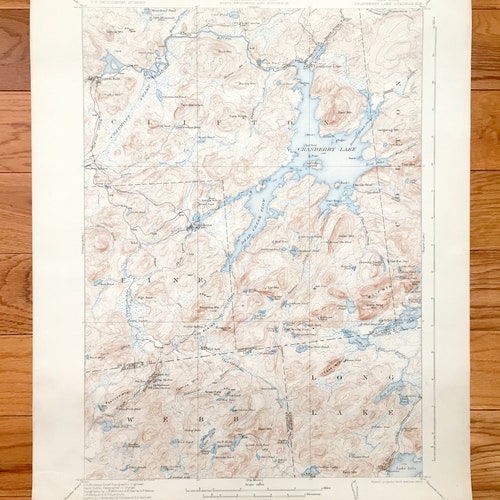
Antique selling Cranberry Lake, New York 1921 US Geological Survey Topographic Map – Adirondacks, Wanakena, Fine, Webb, Clifton, Newtown Falls, NY
Beautiful, antique map of Cranberry Lake, New York and surrounding St Lawrence, Herkimer & Hamilton County area of the Adirondacks. This is an authentic 1921 edition, 1924 print from the U.S. Geological Survey and NOT a computer reproduction.
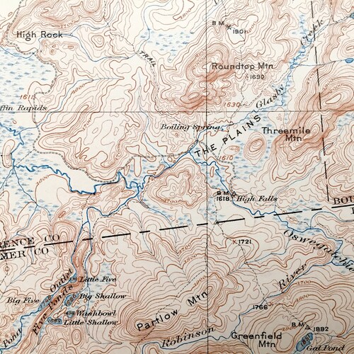
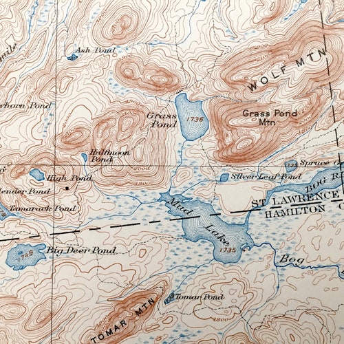
See what New York looked like over 100 years ago. Lots of intricate details and geological contours. Map even has little squares for every house that existed at the time. The USGS cartographers were very thorough back then! On the back is a description of topographic symbols and map guide.
Perfect for the historian, map-lover, the curious or just as a conversation starter. Wonderful and rare. Vintage maps such as this make great gifts.
Edition of 1921, printed 1924
Dimensions: 16 1/4" width x 20" height
----
Features
Cities & Towns: Clifton, Colton, Fine, Webb, Long Lake, Cranberry Lake, Wanakena, Newtown Falls, Benson Mines, St. Lawrence County, Hamilton County and many more.
Points of Interest: Cranberry Lake, Dead Creek Flow, Brandy Brook Flow, Oswegatchie River, Dog River Flow, Mud Lake, Silver, Lake, Bog Lake, Lake Lila, Wolf Pond, Chaumont Swamp, Bear Mountain, State Ridge, Twin Mountain, Indian Mountain, Wolf Mountain, Cat Mountain, Panther Mountain, Deer Mountain and many more towns, train tracks, roads, mountains, lakes, ponds, streams and rivers.
Condition: Very Good Vintage condition, commensurate with age. This map is in great shape for being almost 100 years old. Has light edge-wear and toning but this will all read as vintage character when framed.
----
We will happily adjust selling shipping price for multiple purchases. Maps are rolled up and shipped in sturdy mailing tubes, never folded.