
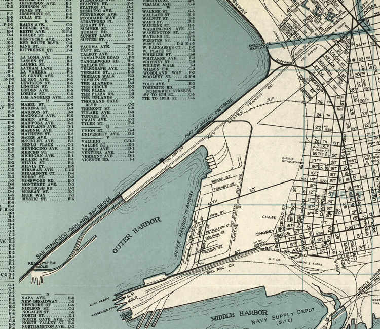


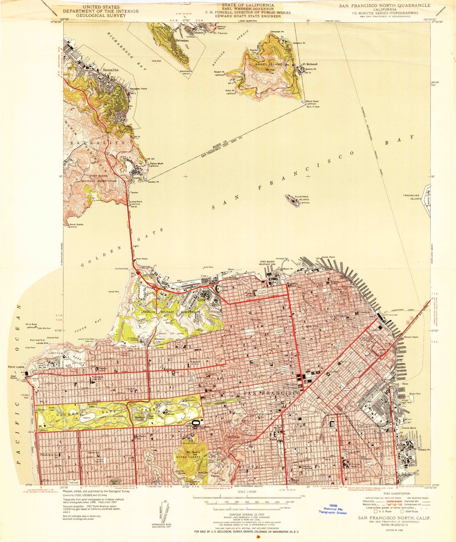
Antique San Leandro, California 1959 US Geological Survey Topographic Map – Oakland, San Lorenzo, selling Alameda County, San Francisco Bay, CA
Beautiful, antique map of Oakland, California and surrounding Alameda County areas. This is an authentic 1959 edition, 1969 print from the U.S. Geological Survey and NOT a computer reproduction.
See what northern California looked selling like more than 60 years ago. Lots of intricate details and geological contours. Map even has little squares for every house that existed at the time. The USGS cartographers were very thorough back then!
Perfect for the historian, map-lover, the curious or just as a conversation starter. Wonderful and rare. Vintage maps such as these make great gifts.
Edition of 1959, printed 1969
Dimensions: 22" width x 27" height
----
Features
Cities & Towns: San Leandro, Oakland, San Lorenzo, San Antonio, Alameda, Mulford Gardens, Russell City, Hayward Landing, Mulford Landing.
Points of Interest: Alameda County, San Mateo County, San Francisco Bay, Bay Farm Island, Municipal Golf Course, Bonaire Park, Knowland State Arboretum and Park, and lots more hills, mountains, brooks, villages, schools, churches, canyons, roads and train tracks.
Condition: Good Vintage condition, commensurate with age. This map is in great shape for being 50 years old. Has light edge-wear and stationary store stamp in margin, but this will add to vintage character when framed.
----
We will happily adjust shipping price for multiple purchases. Maps are rolled up and shipped in sturdy mailing tubes, never folded.