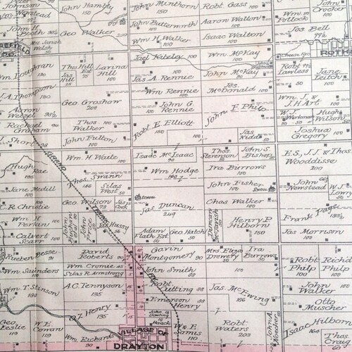
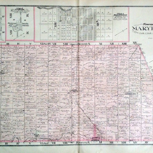
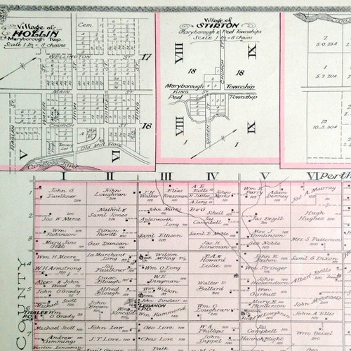
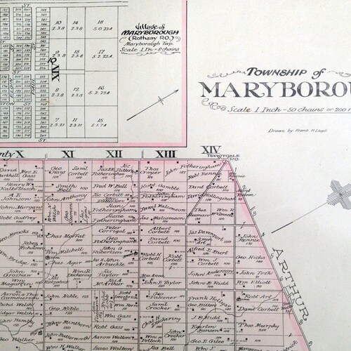
A rare,l arge-scale map showing the township of Maryborough, in Wellington County, Ontario, Canada. The villages of Stirton and Hollin are also shown. From the Atlas of Wellington County, published in 1906 by the Historical Atlas Publishing Co. Drawn selling by Frank P. Lloyd.
The full map is shown in the last photo. Other photos show details from the map.
The map is an original and has some light foxing or smudging, as per photos. Minor tears along the border and fold, if any, have been repaired with archival mending tissue. Otherwise, the map is in good condition. Blank en verso.
All in all an absolutely stunning map to frame or to give as a gift.
For all things Canadian, including other maps, please click on:
http://www.etsy.com/search_results_shop.php?search_type=user_shop_ttt_id_6767040&search_query=canada
Sent to you folded as issued and rolled in a mailing tube. For US and Canadian addresses, this item will be mailed using a service with tracking. For international addresses, shipping is without tracking and insurance unless separately pre-arranged..
Map size: approximately 25" x 16", with at least half-inch margins
NOTE TO INTERNATIONAL CUSTOMERS: We may not be able to ship to some countries during the Covid-19 crisis. If you are interested in this item, please contact us to inquire about possible shipping to your country.
Product code: 1906 Rare Large Antique Map of Maryborough Township, Wellington selling County, Ontario